Tolantongo Caves Weather, Map, and Planning Tips
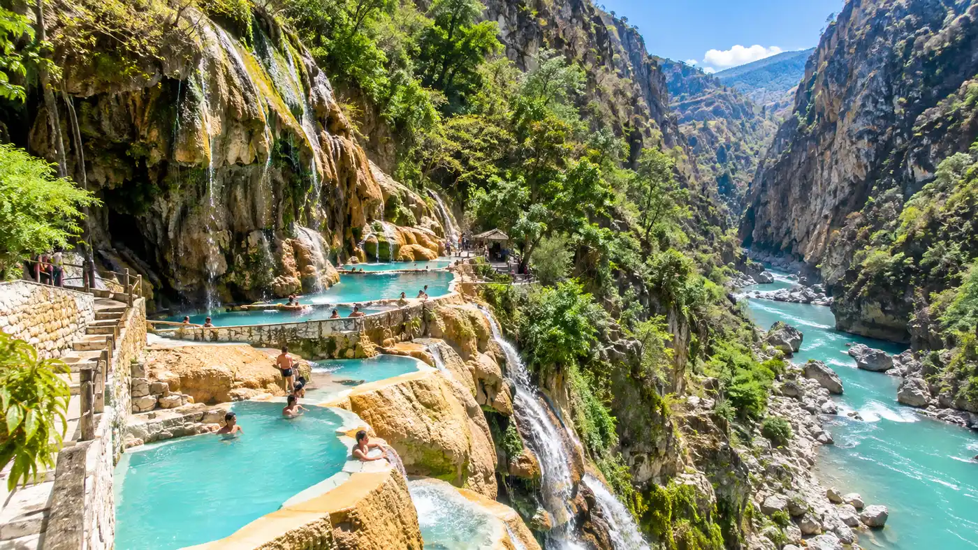
Most travelers imagine stepping into steaming, electric-blue mineral pools under a warm sun, but the reality inside the canyon depends entirely on when you arrive. Checking the local tolantongo caves weather forecast before driving into the Mezquital Valley can save you from a cold, damp, muddy weekend. The canyon sits in a bizarre microclimate where Hidalgo's semi-arid scrub gives way to a lush, humid pocket carved deep into the limestone.
Getting your trip right means understanding how rainfall miles upstream alters the river, how the canyon topography traps chilly air at dawn, and how the massive resort layout actually fits together on the ground. Between the unpredictable mountain weather patterns and the sprawling mountainside layout, navigating this place takes a bit of deliberate strategy.
Book your tolantongo caves experience:
Tolantongo Caves Weather by Season and Why Timing Matters
The canyon floor sits roughly 1,280 meters above sea level, which keeps it considerably warmer than nearby Mexico City or Pachuca. Even so, winter mornings will shock you. From December through February, nighttime temperatures frequently drop near 9°C. Standing in a dripping wet swimsuit waiting for the sun to clear the jagged canyon walls at 8:30 AM is genuinely miserable if you pack only beachwear.
Spring brings the most reliable conditions. Between March and late May, afternoon temperatures climb above 31°C, and the air stays dry. The water feels incredible in the heat of midday, though the sun beats down relentlessly on the exposed stone paths. If you burn easily, shade is hard to come by around the lower riverbanks.
Summer and early autumn mark the wet season. From June through October, heavy rains hammer the surrounding highlands. Thunderstorms roll in quickly during late afternoons. While the thermal water stays consistently warm at around 36°C inside the main cavern, heavy downpours can wash loose silt into the canyon floor within two hours, instantly turning the pristine turquoise river into a churning torrent of brown mud.
| Season | Months | Daytime Air Temp | Rainfall Risk | River Condition |
|---|---|---|---|---|
| Dry & Cool | Nov - Feb | 21°C to 24°C | Very Low | Clear milky blue |
| Dry & Warm | Mar - May | 28°C to 33°C | Low to Moderate | Bright turquoise |
| Rainy Peak | Jun - Sep | 24°C to 28°C | High | Often murky brown |
| Transition | October | 22°C to 26°C | Moderate | Clearing to blue |
If you have flexibility, early November is my favorite window. The hills remain lush and green from the summer rains, but the storm patterns have ceased, leaving the river bright and clean. It is quiet, crisp, and comfortable for hiking between sections.
Reading the Tolantongo Caves Map: Navigating the Two Distinct Zones
Looking at a standard tolantongo caves map can be deceptive because two-dimensional drawings do not convey the brutal vertical drop of the canyon walls. The resort is fundamentally divided into two separate areas: the Paraíso Escondido section and the Gruta section. They sit about two kilometers apart along a winding, steep mountain road.
The Paraíso Escondido area perches high on the western cliffs. This is where you find the famous cliffside thermal pools cascading down the rock face, the suspension bridge, and a hidden thermal tunnel that blasts warm vapor like an underground sauna. The views across the valley from these pools are unreal, but reaching them requires climbing dozens of slick, uneven stone staircases.
Down on the canyon floor sits the Gruta section. Here you find the entrance to the main cave, the warm waterfall flowing directly out of the mountain, and the wide expanse of thermal river where visitors pitch tents. Walking between the two zones takes about 25 minutes uphill on foot, or you can pay roughly 12 pesos for the continuous resort shuttle van that runs every 10 to 15 minutes.
Pro tip: Do not try hauling heavy luggage between the upper pools and lower river on foot. Take the internal resort shuttle, keep small peso coins ready, and drop your bags at your room or campsite first.
Studying a proper tolantongo caves mexico map before arrival helps you decide where to base your day. If you want relaxation and scenery, start early up at Paraíso Escondido before the crowds climb the stairs. If you want the raw power of the cave torrent and swimming in the river, head straight down to the base.
Water Clarity, River Color, and Grutas Tolantongo Photos
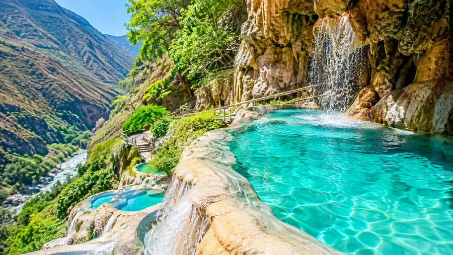
Those jaw-dropping grutas tolantongo photos flooding your social feeds show water so vibrantly blue it looks artificial. That color is real, but it is fragile. The hue comes from calcium carbonate and magnesium dissolved in the thermal springs, which reflect blue light wavelengths when the water is clean.
During the rainy summer, surface runoff from the agricultural plateaus above pours over the cliffs. That runoff carries dark topsoil straight into the thermal river. When that happens, the water turns the color of chocolate milk. The water is still warm and safe to swim in, but it definitely does not match the glossy postcards.
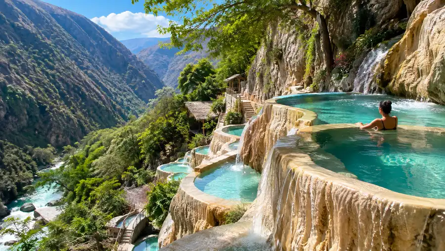
The cliffside thermal pools at Paraíso Escondido, on the other hand, are fed through closed pipes directly from the spring source. Even if the river below looks muddy after a storm, the upper pools generally stay clearer. If your heart is set on capturing stunning tolantongo photos without crowds, you must wake up early. The light hits the canyon rim around 7:45 AM, and by 9:30 AM on weekends, heads are bobbing in every single pool frame.
Damp air inside the main cavern will fog camera lenses instantly. You step inside a natural steam bath where warm water pours from the ceiling with enough force to knock sunglasses off your head. Bring a waterproof phone pouch with an actual lanyard, or leave your expensive electronics in the lockers outside.
Book your tolantongo caves experience:
What Real Tolantongo Reviews Don't Tell You
Reading candid tolantongo reviews reveals an obvious divide between visitors who arrived prepared and those who expected a sanitized luxury spa resort. Tolantongo is an ejido-run collective, owned and managed entirely by local families from the indigenous community of San Cristóbal. It is rustic, loud, vibrant, and thoroughly Mexican.
The terrain is rough. Smooth river rocks will bruise your arches within twenty minutes if you try walking in bare feet or flip-flops. Hard-soled water shoes are not just recommended, they are essential for your survival across the slick limestone surfaces.
Note: Credit cards are not accepted anywhere inside the canyon complex, including hotels, ticket booths, and restaurants. There are no ATMs on site, so bring all the cash you need from Ixmiquilpan.
Packing for this canyon requires balancing warm-weather swimming gear with cold-morning layers. Here are the items that make a practical difference:
- Sturdy water shoes: cheap neoprene socks tear instantly on the river gravel; buy thick-soled river booties.
- Waterproof dry bag: a 10-liter roll-top bag keeps towels dry while you wade through dripping cave entrances.
- Warm fleece sweater: mornings in the canyon get surprisingly cold while waiting for breakfast stalls to open.
- High-intensity headlamp: entering the deeper chamber inside the main gruta requires both hands free in total darkness.
- Small bills: lock rentals, bathrooms, snacks, and shuttle rides all require cash change under 50 pesos.
Strategic Planning Tips for Beating Crowds and Bad Tolantongo Caves Weather
Visiting on a Saturday afternoon during a holiday weekend is an exercise in crowd endurance. Buses from Mexico City unload hundreds of visitors simultaneously, and the narrow dirt lanes fill with folding chairs, portable speakers, and barbecue smoke. To experience the tranquil mountain sanctuary from the photographs, timing is everything.
Tuesday and Wednesday are easily the quietest days. The water has had time to settle after weekend foot traffic, hotel check-in lines vanish, and you might find yourself sharing the upper pools with only three or four other people. Arriving around noon on a Monday gives you two tranquil days before the Thursday arrivals start filtering in.
To maximize your itinerary regardless of the forecast, organize your days around the mountain light and thermal cycles:
- Early morning (7:00 AM - 9:30 AM): head straight to the cliff pools at Paraíso Escondido for empty water and gentle morning sun.
- Midday heat (11:00 AM - 2:00 PM): retreat to the shaded depths of the main cavern where thermal steam shields you from the scorching sun.
- Afternoon cooling (3:00 PM - 6:00 PM): float down the thermal river as the sun drops behind the canyon walls and the air cools off.
- Evening dinner: grab grilled cecina and warm consommé from the local comedores before kitchens close around 8:30 PM.
Keep in mind that hotel rooms cannot be reserved online or over the phone. Everything operates strictly first-come, first-served at the registration desks. If you visit on a Friday or Saturday, arrive at the main gate before 7:30 AM to secure a room, or prepare to rent a tent and camp alongside the riverbank.
Frequently Asked Questions about tolantongo caves weather
What is the coldest month to visit Tolantongo?
January is generally the coldest month. Nighttime temperatures drop to around 8°C or 9°C, and early mornings remain chilly until the sun clears the canyon peaks around mid-morning.
Does it rain all day during the rainy season?
Rain usually falls in intense late-afternoon or evening cloudbursts rather than continuous all-day drizzle. Mornings are often sunny, but afternoon storms can quickly cloud the river water with mountain silt.
Can you swim when the river turns brown?
Yes, the river remains warm and safe to swim in during rain runoff. The discoloration comes from natural clay and limestone soil washed down from the slopes, not industrial pollution.
Quick Reference
- Elevation: 1,280 meters
- Water temperature: 34°C to 38°C
- Best months: November through April
- Payment policy: Cash only (no ATMs)
Book your tolantongo caves experience:
Before You Go
Tolantongo rewards travelers who look past the curated images and plan for the practical quirks of a deep mountain canyon. Check the mountain forecasts for Hidalgo, bring far more cash than you think you need, pull on some sturdy water shoes, and enjoy the mineral steam rising through the morning chill.
Read more about tolantongo caves.